Archive for May, 2012

27 May 2012

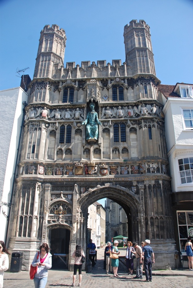
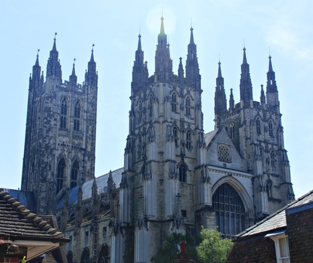
The sun was shining nice and bright as we set off for Dover. As I was already familiar with the GPS from the day before, we got on to the motorway without much incident. The scenes along the road were quite pleasing with nice pastures and farms. A bit into the journey, we saw the signboard to Canterbury and decided to stop there on the way. Canterbury is very famous for its cathedral and held an intrigue because of Canterbury Tales, even if I have not read it. Unfortunately, when we arrived at the Cathedral, it turned out that access to most parts of the Cathedral was closed due to some service going on and would open only after lunch. However, that would have interfered with our Dover plans and so we decided to give that a miss and I could just a couple of shots from the outside.

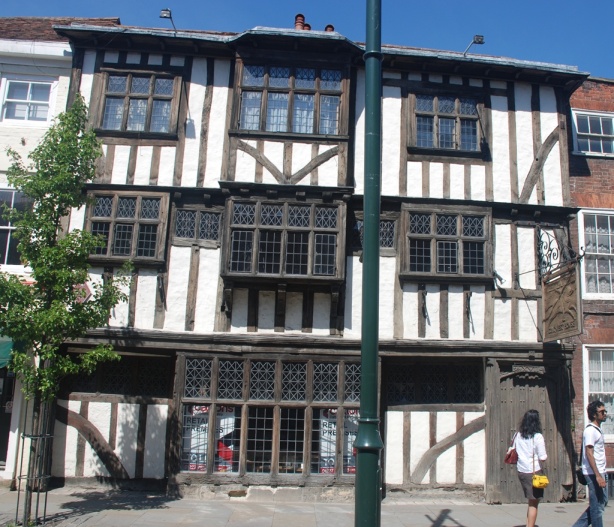
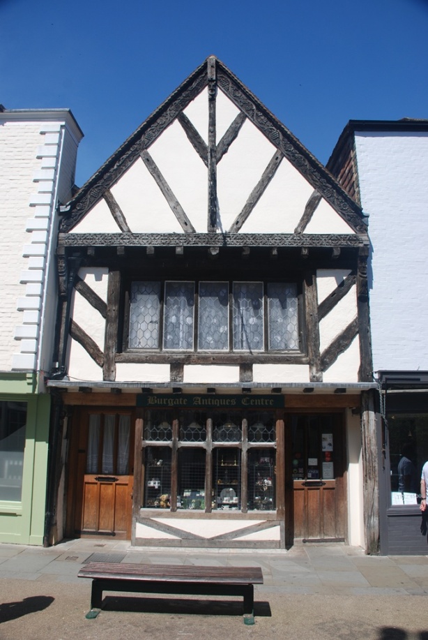
We walked around the town and it was obvious that most of the shops catered to tourist trade. However, the walk itself was interesting as there were many nice looking old houses in the town.

There was one particular house that was tilted to one side and my friends who are experts in architecture told me that this would have happened with age and it seems this happens with many old houses. If I were not with them, I would have thought that the house was constructed so!

After a refreshing cup of coffee, we were soon hurtling towards Dover. Dover is on the seaside and I had read about the white cliffs of Dover when I was young. In one of the books we had on the Second World War, I had also read of the evacuation of Dunkirk and the role Dover played in that. Hence, I was very eager to get to the castle.

The castle was built between 1179 and 1189 by one of the most powerful monarchs in Europe at that time, Henry II. The castle has since expanded and covers a large area now. The castle itself stands on an old Roman location where they built a lighthouse in the first century and it can be seen even today. Dover itself was seen as the “key to England” and withstood many attacks from the Romans, Normans, French and finally the Germans. The French coast is just 60 kilometres away, across the channel, and is visible on a clear day from the castle. It seems that all it took for a shell that was fired from Calais in the French coast to reach Dover was 70 seconds!

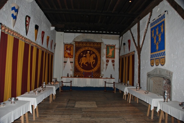
The castle itself is preserved pretty well and the building called the Great Tower forms the core of the castle – it has multiple levels with a hall for gatherings, living area of the King, a small chapel etc. The rooms are very colourfully decorated and I am not sure whether this is a modification of the modern times or whether this was so in the early days. Generally, I have seen that Europe is rather drab in its colours and lack the vibrancy that we see in India. There were a couple of actors dressed up as the King and the Queen, conducting a mock court for the tourists and I thought that was rather tacky.

In one of the rooms, I saw a coat of mail, shield and a sword. All this was so very heavy that I was quite surprised at the strength of the men that would have worn those. I lifted up one arm of the coat of mail and that itself was too heavy for me. Someone said that the knights had to be lifted on to the top of their horses after they had worn all this armour, as it was impossible for them to get up there by themselves!

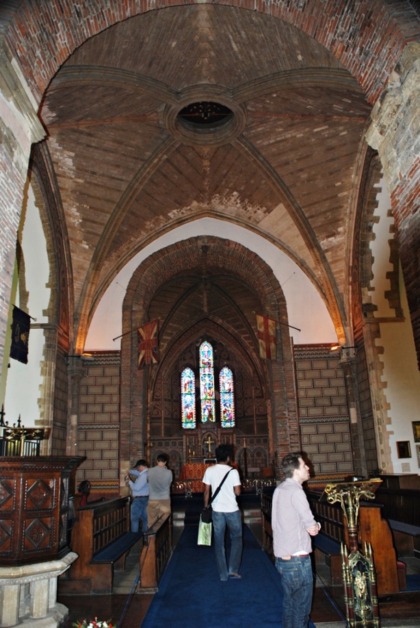
Right outside the main castle is the old Roman lighthouse and a small church alongside it. It is an old church that has served the military for many years. The interiors of the church were quite sparse and there were many flags inside.

Given the strategic significance of Dover, it was but natural that it became an important military location. In 1940, when France fell, about 400,000 Allied forces got stranded at Dunkirk in France; they had the Germans behind them and the English Channel ahead of them. Speaking at the House of Commons, Winston Churchill said that the “whole root and core and brain of the British Army” was stuck at Dunkirk and they faced death or capture by the Germans. An evacuation was ordered and it started on May 27, 1940 and ended early in the morning on June 4, with the rescue of 338,226 soldiers. While it was an evacuation and so a retreat, Dunkirk was still regarded as a victory as the British Army would have been crushed had they failed to rescue those troops.  Many German commanders considered that Germany’s biggest mistake in the Western Front was its’ inability to stop the Dunkirk evacuation.  It was on June 4th, after the evacuation, that Churchill made his famous “We shall fight on the beaches” speech.

Vice Admiral Bertram Ramsay lead the whole exercise from the dynamo room (hence the operation was called Operation Dynamo) in the naval headquarters, located in the tunnels under the Dover Castle. It was a large scale logistics operation conducted under extremely dangerous conditions. The whole nation was focused on Dunkirk and many civilian ships and even small fishing boats (it seems the smallest one was but 18 feet long) took part in the exercise and that was why it was successful.

The tunnel system under the castle is very extensive and Admiral Ramsay had his headquarters there. We took a conducted tour through the tunnels and saw office rooms, living quarters, telephone equipment room, repeater station etc. It must have been quite an effort to spend days in there with a war going on. Unfortunately, they do not allow any photography in the tunnels as the fire sensors are supposed to be quite sensitive and might give off alarms when the camera flashes go off. As we walked through those tunnels, exactly 72 years after the day the evacuation started, I could not but feel the tension and the pressure that must have gripped the people that lived there at that time. War causes so much suffering and sorrow – yet, we are forever in wars!

The view of the sea from the battlements was quite nice and we could indeed, see France in the distance. Dover castle is quite different from the many other castles I have seen as it looks very functional; probably because it was used even as close as fifty years back.

Since we were standing on the cliffs themselves, we could not see much of the white cliffs except what we could see by looking up. These cliffs are largely of chalk. During the cold war period, the British Government equipped the tunnels to be a base and retreat for the leadership, in case of a nuclear attack. However, it was found later that radiation would have seeped in through the chalk cliffs and hence the location was abandoned.
21 May 2012

As it often happens, the places that are the closest are often the ones that are farthest! This has been so with me, in the case of Tippu’s Fort which is located at Palakkad. Palakkad is but 15 Kim’s from my hometown, Chittur, but I have never visited the fort after my schooldays; which, admittedly, was way back. So, I had decided that I would make it to the fort this time around when I went to Chittur.

The fort has been restored quite recently and some of the ramparts that had fallen down have been rebuilt. It dates back to medieval times and was renovated by Hyder Ali (Sultan of Mysore) in 1766, when he was invited there by the king of Palakad to help against an invasion threatened by the Zamorin, the king based in Calicut. Hyder took advantage of the opportunity, realizing the strategic significance of Palakkad. The fort changed hands a few times between the British, Hyder Ali and his son, Tippu Sultan till 1790. The British controlled the fort from 1790 onwards and used it as their base. Even today, the fort is known as “Tippu’s fort” even if Tippu held the fort only for a few years and was not the one that built it. When I thought about it, I was happy that there were at least some monuments left as remembrance for this brave and patriotic son of India.

I have felt that Tippu Sultan has often been sidelined and his role in history underplayed, by vested interests. He was one of the very few kings in South India that realised the threat the East India Company and the British posed. His wars with the British have been well chronicled and even though he succumbed in the end, he remained a thorn in the side of the mighty British for many a year and that too when all the rulers of the neighbouring kingdoms had meekly surrendered, out of cowardice and for personal gains. He had the vision of free India and fought for it, ultimately giving his life. As a true hero, he fell in battle, fighting till the very end.

Yet, he is painted as a religious fanatic, one who was only interested in converting Hindus to Islam. No matter that the first sight that greets you as you walk into his fort in Palakkad is a Hanuman temple – one of the most powerful Hindu gods. This temple is a big favourite with devotees even today. It also does not seem to matter that the very famous Srirangam Temple stands within Tippu’s fort and stronghold at Srirangapatnam and I cannot imagine that it would have been a huge effort for him to mow it down. It is obviously of no significance that it was Tippu that sent money to help the Kanchi Mutt after that Hindu monastery was ransacked by the Hindu Maratha rulers. The list goes on and I am just writing what I have seen and heard and by no means am I an expert. I am sure that his armies would have raped and plundered as is the wont of victorious armies but then, which victor has ever held his forces back after a battle? Even today, in our “cultured” ways, the spoils of war go to the victor.

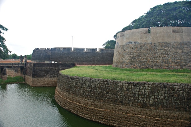
The fort itself stands on a small hill and there is a large moat surrounding it. In my childhood, I had heard stories that only Tippu’s horse could leap over the moat and when I looked at the size of the moat, I realised that it was just that, a story, given the size of the moat.

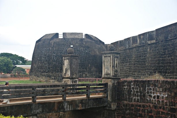
There is very little water in the moat today and you enter the fort through a small bridge.

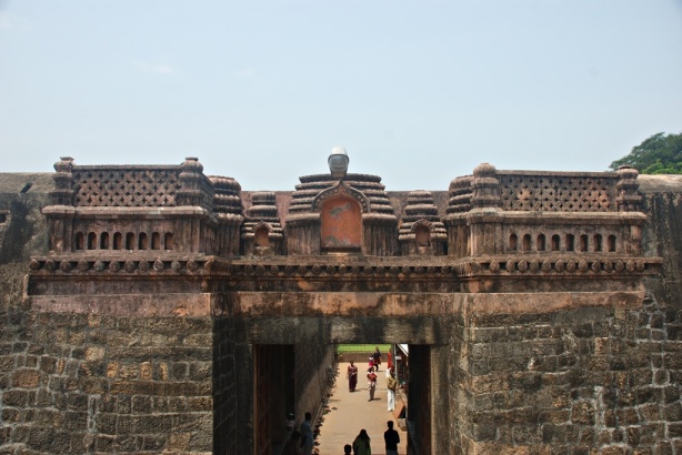
The fort itself is very functional and is built with large granite boulders and limestone. It is of rhomboidal shape shape and has seven bastions with very thick walls. There does not seem to have been much effort spent to make it beautiful in any way. At the main entrance, I saw some decorations on the wall above the door and that was pretty much the only decorative piece I saw in the entire fort.

As you enter, on the right, there is a small idol of Hanuman set into the wall. This has now become a very famous temple and there were many devotees even at mid-morning, when we went in. I was not allowed to photograph the temple itself, in keeping with the recent form of intolerance which denies entry to non-Hindus to temples. I also noticed that the temple itself had a “saffronised” look with the imagery and colours used and even with name of Ram, written in Hindi. Perhaps this is a good indication of who controls this temple and I felt one could easily transport this temple to North India and it would fit in there very well.

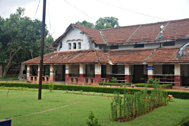
In the centre of the fort, there are a few buildings and this must have been where the people that stayed in the fort lived. The buildings do not look as old as the fort and must have been constructed during the times of the British. There is a very well maintained lawn with a couple of large trees.

There is also a stepped well on one side of the courtyard and I learnt from the Information Centre that this well was dug later.

The Information Centre is hosted in an interesting stone building with 28 pillars, which was also constructed later. Unfortunately, there is not much information provided about the fort or the battles that were fought there or the people that lived there. There are some photographs of the restoration and of other places of tourist interest in Kerala.

One of the buildings houses a jail and that was of personal interest to me as my father was imprisoned here for two weeks in 1961 when they were agitating for the implementation of the Land Reforms Act in Kerala. I guess the jail must have been in the same old shabby condition even 50 years back.

There is a walkway that takes you around the wall of the fort and there were some good views all around. One could see that the fort offered a very good defensive position. I was quite disappointed that there were no markings or indications of any of the places of interest within the fort or any details provided about its history. There is a small board at the entrance with a few lines on it but that hardly does justice to the place. It was equally disappointing that there was no mention of Tippu or Hyder or anyone else that lived there. But, the people of Palakkad still honour that valiant son who was the first to rise against the British in South India and call it Tippu’s Fort…..


I started off a little before lunch in the Jeep and the destination was the Pegasus camp about 60 km away from Bangalore. This was the first time that I had dared to take my 1967 model Jeep outside the city since I bought it. So, it was with some apprehension that I set off and it looked others too had the same apprehension as Sandhya kept calling me in between to check whether all was fine. In the end, I felt I should have been more confident of the Jeep – it was a smooth drive all the way through. Driving on the countryside with a Jeep, which is partially open is so much more fun even in the summer. You felt a bit more in touch with the surroundings and not cocooned.

The camp is in the middle of nowhere with the nearest village being a small one called Kallukote. I have always been struck by how pronounced the change is between Bangalore and the rural areas surrounding it. Just 50 km off Bangalore and you are in real rural heartland. Probably I feel this more because in Kerala there is not that much difference between cities and the rural areas.

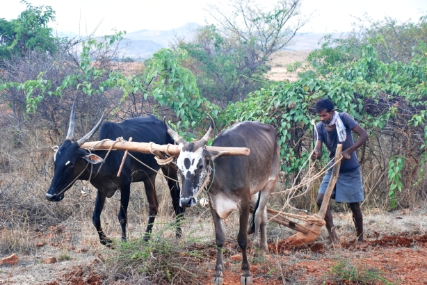
I was driving along in good cheer and stopping to take photographs once in a while. The land looked well irrigated and most of it was under cultivation. It was good to see land being put to good use and not being barren. As I stopped for one such photo break, I saw a sight that I had not seen since early childhood – a man ploughing his land using bullocks. He was kind enough to allow me to take photos of him. His name was Vasanthappa and he said he grows maize in his fields. It was quite amazing that within 50 km of one of the largest cities in one of the largest economies of the world, a man was still ploughing his land using a technique which was centuries old. I guess a tractor must have been beyond his means.

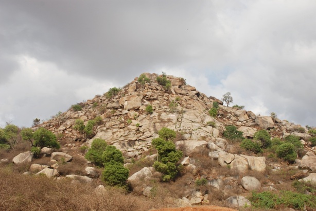
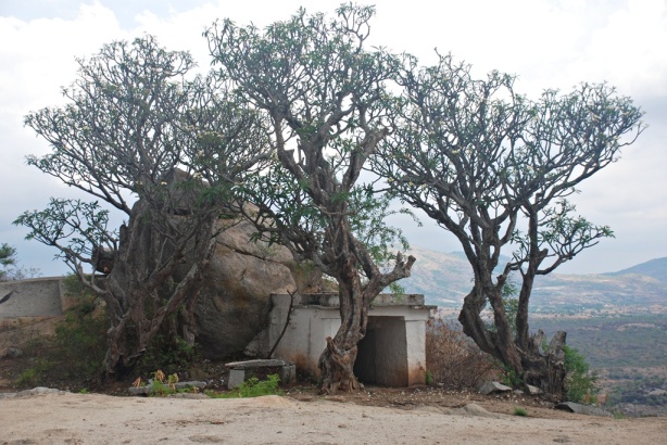
Very near the camp is a Lakshmi Narasimha temple and there is a medium size hill (about 700-800 ft high) right beside it. There was a villager standing near the temple and he told me that they had another temple right on top of the hill. He showed me a post right on the top where he said a lamp was lit on particular days. I was curious and wanted to go up the hill.

So, I went to the camp, freshened up and came right back. There was a rough, rocky road cut into the hill side and my Jeep would have gone up that track, steep as it was. However, since I have no experience with such riding and as I was aapprehensive of causing some damage to the vehicle, I parked it near the temple and proceeded up the hill on foot. As I started walking, I realised that I was alone on the hill. It was a bit of an odd feeling, it was so silent and still all around. The path was reasonably easy, though a bit steep and I was at the top in about 20 minutes and what a sight it was!

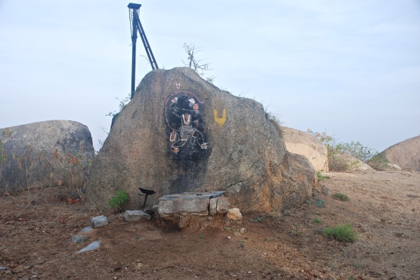
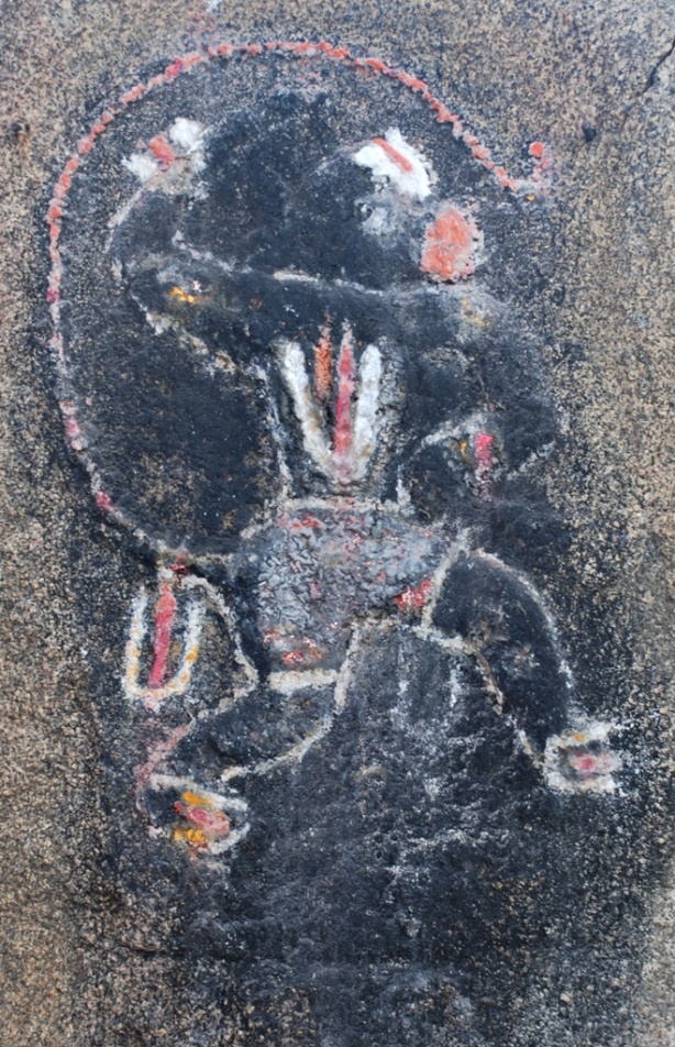
The temple itself was a very small but what attracted me more were the steps that led up to it and a drawing of Hanuman done with charcoal or something like that, on a rock. The image, the steps and the tree beside it all combined to provide a nice ambience. The highlight of the whole experience was, of course, the simplicity of everything. Simple lives, simple beliefs, simple temples, simple gods…..

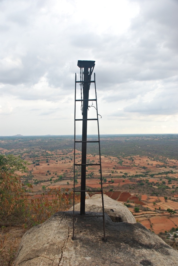
The post that the villager had shown me was driven into a rock and was almost at the highest point.

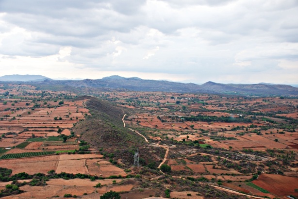
The views all around were fantastic with majestic hills looming in the distance. There were many small villages to be seen but most of it was agriculture land.

I sat there for sometime absorbing the stillness and the quiet. It actually takes effort to get used to that. One is far more comfortable with all the noise that one is surrounded with, in the city. It was a bit eerie to think that I was all alone on that hill. It was a very nice feeling and needless to say, was the highpoint of the day. I will be back here soon….